

# Use Cases
Land Vehicle Navigation In GNSS-Denied Environments For Defense Applications
Problem We Solve
In order to safely travel from one location to another during an operation, or maintain navigation capabilities in a contested environment, ground vehicle crews need ways to protect against GPS satellite signal threats and ensure that they reach their intended destination. Operating in a GNSS-denied environment presents challenges to most navigation systems, because they can either be jammed, or deceptively guided off course via spoofing attacks.
An Inertial Navigation System (INS) that provides reliable position and heading data without the aid of GPS satellite signals is a unique backup solution because it allows vehicles to stay on course and maintain awareness of where they are as if they never lost connection with GPS. An INS can provide the critical current-location data and ensure that other navigation equipment continues to operate during the mission.
Why it is Important
Precise location and navigation capabilities are essential for mission planning, execution and coordination with other units. Inaccurate navigation can lead to mission failure, unintended engagements, or even friendly fire incidents. Ground vehicles in defense operations often navigate in challenging environments where traditional GPS signals are weak or unreliable. This includes dense urban areas, heavily forested regions, or any areas where enemies employ electronic warfare to disrupt GPS signals. Navigating accurately in such conditions is crucial for mission success and the safety of personnel. Therefore, having a robust navigation system that can provide both location of the vehicle real time as well as where the next waypoint is (and how to get there) is of paramount importance for defense applications.

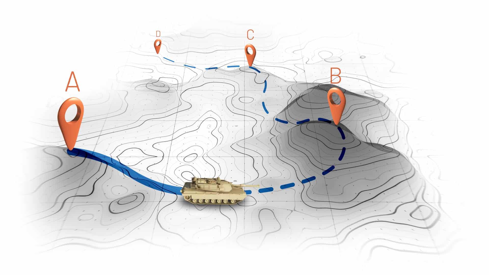
In the diagram above, we can see that when a vehicle passes through an GNSS-denied area, its navigation system might be thrown off and report a different location compared to the true position. However, with an accurate INS, it can continue along the intended route as well as stay free from excessive drift. Drift occurs when the navigation system is not using external signals for navigation, but rather an internal INS and over time, the accuracy worsens.
Of course, there are different grades of accuracy for waypoint navigation depending on your needs. And we’ll cover the most relevant solutions below.
How We Solve it

Safran has developed a dependable inertial navigation system – The Geonyx – that provides route guidance in GNSS-denied environments. The Geonyx ensures that the vehicle can navigate effectively between waypoints in spite of satellite signal interference. It incorporates HRG based inertial navigation system (INS) technology. Unlike GPS, INS does not rely on external satellite signals for navigation and heading. Instead, it uses motion sensors and rotation sensors to calculate the position, orientation and velocity of the vehicle based on internal data. The Geonyx will output coordinates of the vehicles current location as well as the data on its intended position to the vehicle’s battle management system (BMS). The Geonyx is able to maintain an acceptable level of position accuracy for up to 24 hours.
GEONYX INERTIAL NAVIGATION SYSTEM
Geonyx is a combat-proven INS solution for ground vehicles, augmenting battle management systems. With its ruggedized design, it offers a virtually unlimited and maintenance-free lifespan. It can achieve a heading accuracy of <0.85° RMS degrees thanks to HRG Crystal technology. It has quick and flexible alignment – even in GNSS-denied environments.
Why Choose Us
Safran is renowned for its expertise in aerospace and defense technology.
It stands out for its:
- Excellent Drift Performance – The Geonyx provides you with continual location and waypoint information with very little drift over a 24 hour period, often outperforming other land-based RLG/FOG-based inertial navigation units.
- Flexible Systems Integration – Geonyx can be mounted in any orientation on a variety of land vehicles while providing industry standard interfaces for ease of use integration.
- Ruggedized Operation – Thanks to HRG Crystal technology, the Geonyx is unaffected by vibrations and shocks of artillery guns, enabling a virtually unlimited and maintenance free lifespan; 100,000hr MTBF.
- Jamming & Spoofing Proof – Geonyx will provide your Battle Management System BMS (or any other onboard system) with accurate location, waypoint, destination and heading data even in GNSS-denied environments.
Discuss Your Solution