Protecting GPS-Reliant Military Systems

Print

GNSS (Global Navigation Satellite Systems) is great, until it’s gone. It really is a marvel of the modern era – enabling positioning, navigation and timing (PNT) applications used by individuals, commercial enterprise and governments all over the planet.

While the use of GNSS – more commonly known as GPS – is now widespread, the signal itself comes from satellites that are 20,000 kilometers away, making it fairly weak and subject to loss of signal or interference. For military operations, this presents several challenges. In a recent naval exercise, a scenario of GPS denial triggered up to 48 shipboard systems to generate alerts when GPS was lost. This shows how GPS is so pervasive and deeply integrated into many military systems for air, land and sea.

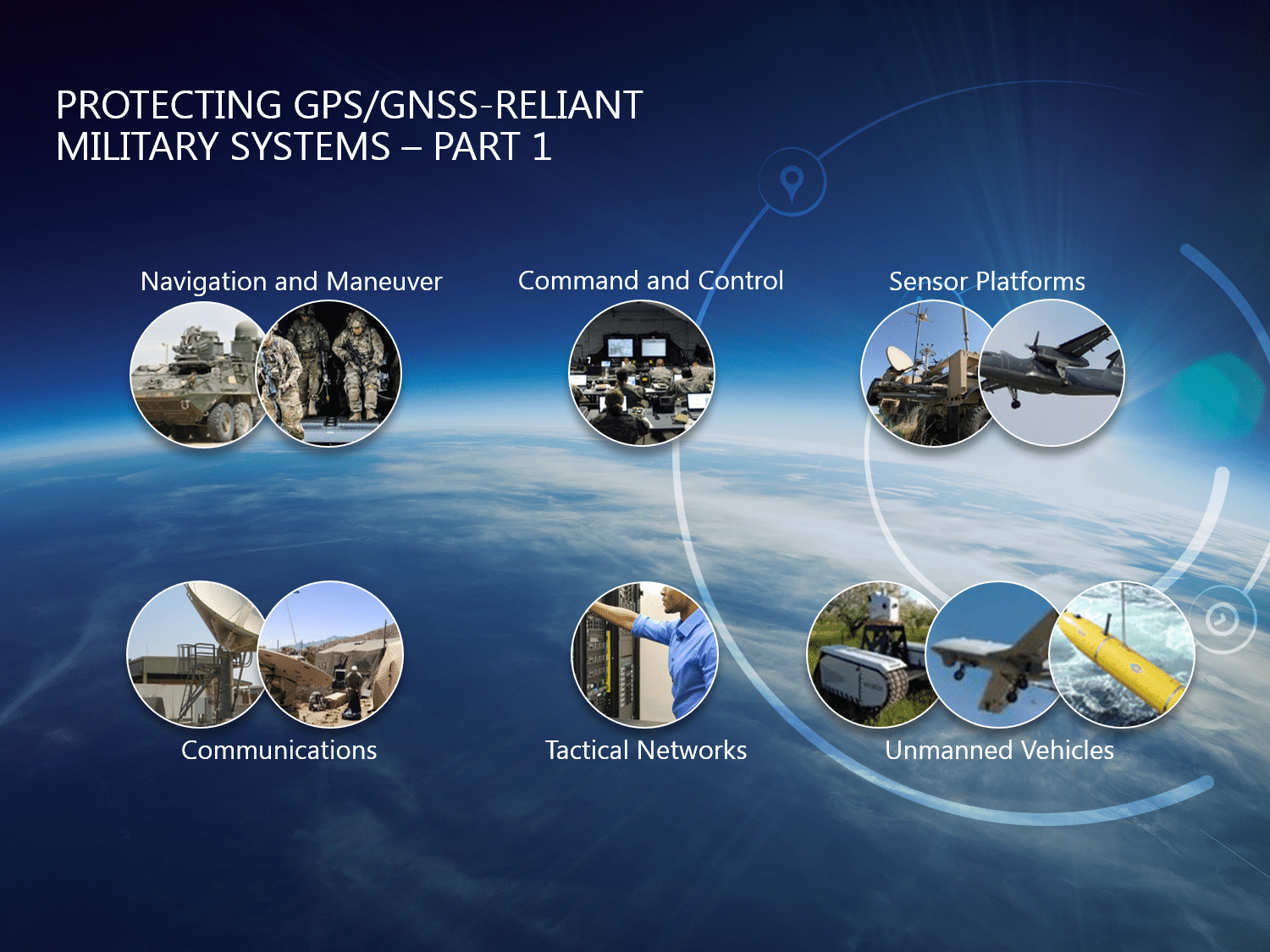
In very basic terms, a warfighter needs to do three things: move, communicate and act. GPS is well known for its role in navigation, but it is equally important in C5ISR systems – Command and Control, Communications, Computers, Cybersecurity, Intelligence, Surveillance and Reconnaissance – the systems that allow the entire mission to successfully operate.

Command and Control

Command and Control is tasked with making the most intelligent command decisions based on the most accurate situational awareness. Without precise location, navigation and timing data (which enables synchronization), Command and Control centers could be in the dark or with misinformation. Warfighters on the frontlines rely on Command and Control for blue force tracking as well as tracking threats and enemy forces. Not only must PNT data be accurate, it must be transmitted and received as near-instantaneous as possible and distributed to the appropriate systems. Decision support systems that are properly networked and synchronized operate much faster and can better support Command and Control teams.

Intelligence, Surveillance, Reconnaissance

These are the eyes and ears of the warfighter – sensor systems like cameras (standard or infrared), radar, lidar, sonar and other signal intelligence receivers that are continuously monitoring, detecting, collecting and transmitting data. Recipients of this intel need to know exactly where those samples came from, when they were taken and when the last update was sent. The frontlines are a rapidly changing environment; everything moves very quickly and very dynamically; the collected data must be accurate, timestamped and precisely synchronized.

Time-Sensitive Targeting

Once situational awareness is understood, troops must take action: find the target, get a fix on its position, track its movement, engage and then reassess, repeating this cycle until they achieve their objective. GPS’ accurate PNT data enables troops to engage with threats, target them with laser precision and effectively minimize collateral damage.

Now that we’ve explored where GPS is utilized within military systems, we can imagine what would happen if warfighters faced a GPS threat or disruption.

As is widely understood, GPS signals are weak and vulnerable to interference. Interference can be unintentional, such as side band energy from radio transmissions on the battlefield, or intentional. Intentional interference can be jamming or it can be a fake signal, sometimes called spoofing or sophisticated jamming. Spoofing is potentially the most dangerous type of interference. Connectivity and signal disruption is one issue; acting on misinformation or falsified data could be catastrophic.

The Battlefield Without GPS

The dependency on GPS is so widely rooted that it’s easy to undervalue its benefits. There are many advantages when military forces have a full digital C5ISR (Command and Control, Communications, Computers, Cybersecurity, Intelligence, Surveillance and Reconnaissance) system. What happens when that is lost? Communications start to degrade, and secure communications might be compromised. Much of the synchronization of secure voice and data systems uses GPS. Without digital navigation, operations are back to using paper maps. Situational awareness is slower, and when warfighters lose speed they lose the tactical advantage. When digital data and digital input are gone—so are the automated systems that rely on them. In a word, it’s bad.

Layers of Defense = Assured PNT

GPS threats are complex – there are a variety of entry points and strategies to defend against. Military troops must operate under the assumption that GPS will fail, and be prepared for such an event. At Orolia we believe the best defense is a layered approach, what we call “Assured PNT”.

The first layer is access to multiple constellations, including GPS, Galileo, GLONASS and Beidou. An intelligent warfighter uses all the assets at their disposal. While a higher integrity PNT indication may be obtained from an agency’s own internally approved system, there are times during GPS denial that other signals may be available. Why not use them if the adversary is?

The next layer of defense for jamming is to prevent the jamming signal from reaching the receiver in the first place. Advanced antenna technologies, both passive and active, now exist. For example, CRPA (Controlled Radiation Pattern) antennas that can focus reception beams directly towards the satellites and away from the jamming source.

For data integrity, military systems have SAASM and M-Code, the encrypted military signals. These defeat spoofing. Galileo’s new Public Regulated Service (PRS) is an encrypted navigation service that has improved availability and continuity of service, as well as better resistance against spoofing and jamming.

For situations where jamming or spoofing threats are unavoidable, Safran partnered with Talen-X to incorporate its Broadshield GNSS jam and spoof detection capabilities into Safran’s PNT solutions. Detecting the problem is the first step toward correcting it.

The next layer is to look for alternative navigation signals. For example, ranging with either radar or by measuring the time delay of data packet transmissions, allows an estimated position based on proximity to other things and other transmitters. There are also pseudolites – pseudo satellites that are put on the battlefield to replace or substitute in for the normal GPS satellites – but they send a much stronger signal and can combat interference.

Lastly, internal, precise navigation devices can be used – an inertial measurement unit (IMU) containing accelerometers and gyroscopes that help navigate and are nearly impossible to jam as they don’t rely on external signals. Likewise, in the timing area using internal clocks disconnects the system from external sources that can be corrupted. In fact, an atomic clock has become practical and miniaturized enough for use in mobile applications.

At Safran, we have approached the Assured PNT requirements with flexible, configurable and scalable systems to meet the needs of each different application. But we are not stopping there. There is a whole realm of possibilities to provide Assured PNT, and we are exploring many of them for both military and commercial applications.

While GNSS-reliant military systems have vulnerabilities, there are technology solutions available today that ensure the integrity and continuity of PNT data. As these technologies continue to make their way to the battlefield, warfighters will be able to move, communicate and act with confidence for mission success.

Related Resources Related Resources